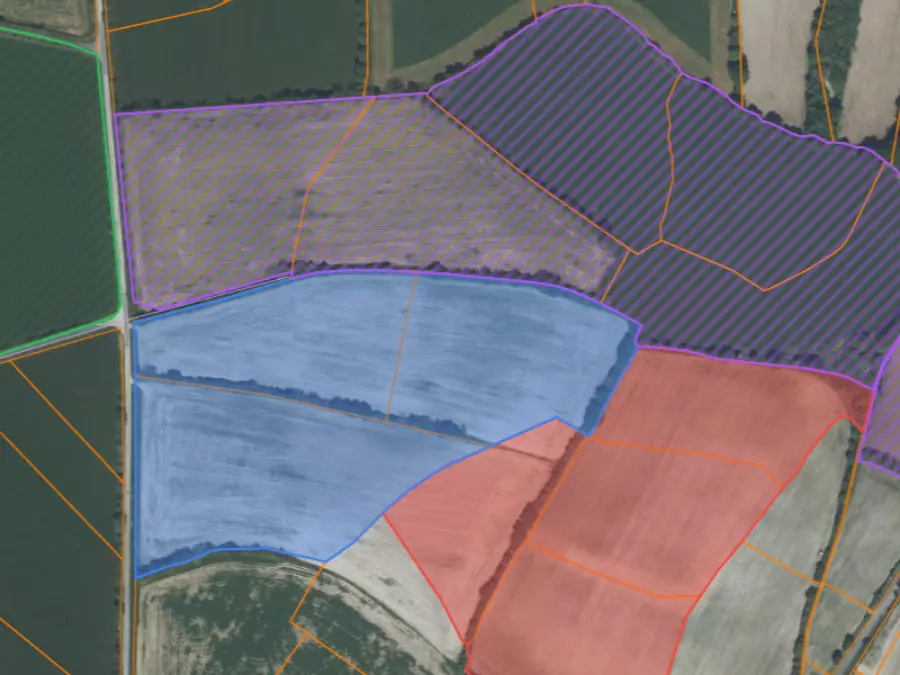
Draw your hunting ground on the land registry
Magic wand, lasso or freehand. Tap a parcel, it joins your hunting zone, and the outline of your hunting ground draws itself.
Draw your hunting ground on the official land registry, number your stands and draw your drives. Everything happens in your browser, with nothing to install.
Free, no download, on mobile or desktop
+1 000 hunting grounds equipped with Mes Chasses across France

What you can do
Magic wand, lasso or freehand. Tap a parcel, it joins your hunting zone, and the outline of your hunting ground draws itself.
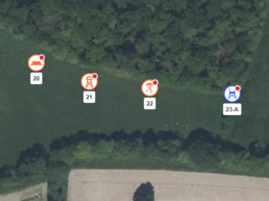
High seat, ground stand, pigeon hide, hide: each stand shows its type and number, the same one announced at the meeting point.
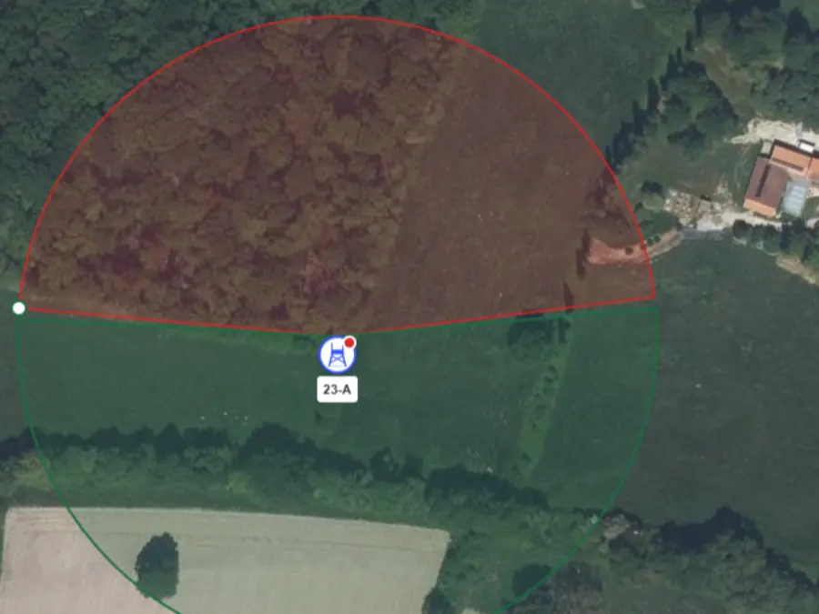
For each stand, the permitted angle and the forbidden angle. The instruction becomes visible instead of being repeated aloud.
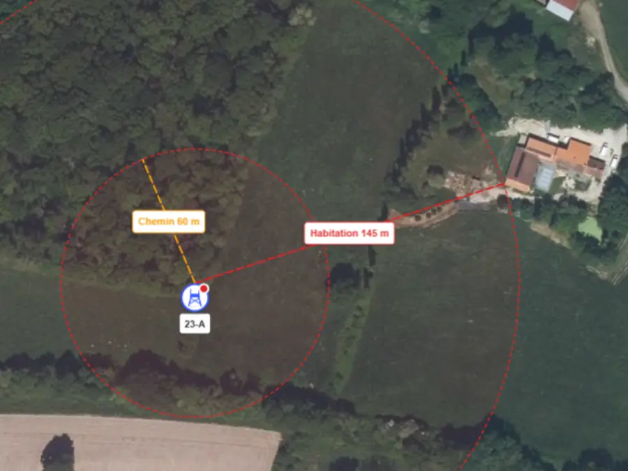
The distance to the nearest dwelling and to the nearest path, measured for you.
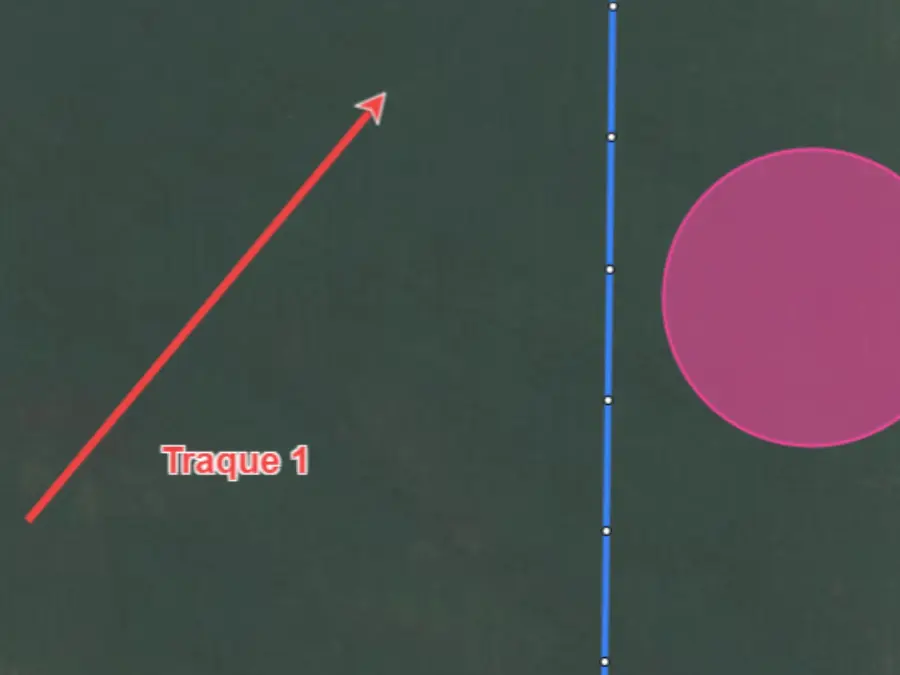
Drive arrows, shooting lines, enclosure circles. The distance appears as you draw.
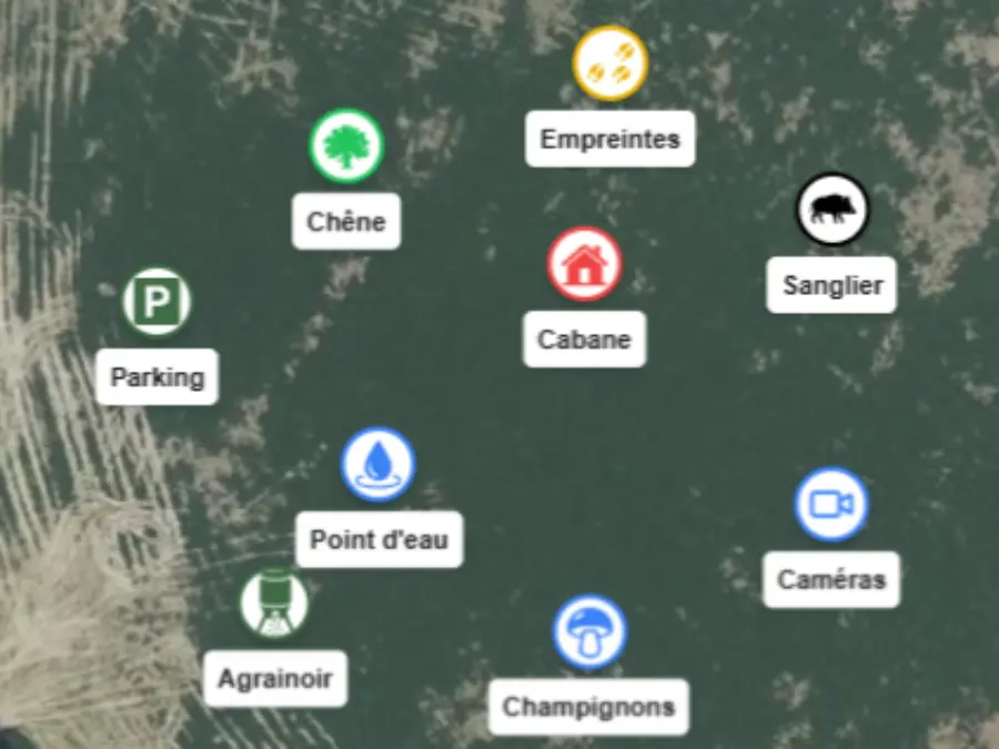
Over 150 nature and hunting icons: feeder, cabin, water point, car park, camera, tracks.
Video tutorials
Draw the hunting zones from the cadastre, parcel by parcel.
Draw a line of hunting stands and see how many hunters it can take.
Place high seats, feeders, wallows, camera traps, car parks and barriers on the hunting-ground map.
Read the relief of the hunting ground: contour lines, slopes and elevation profile.
Show power lines, buildings, roads, tracks and water points on the hunting map.
Print your hunting-ground map as a PDF (A5 to A1) or export it as a very high resolution image.
All the tutorials in the hunting map YouTube playlist.
Terrain layers
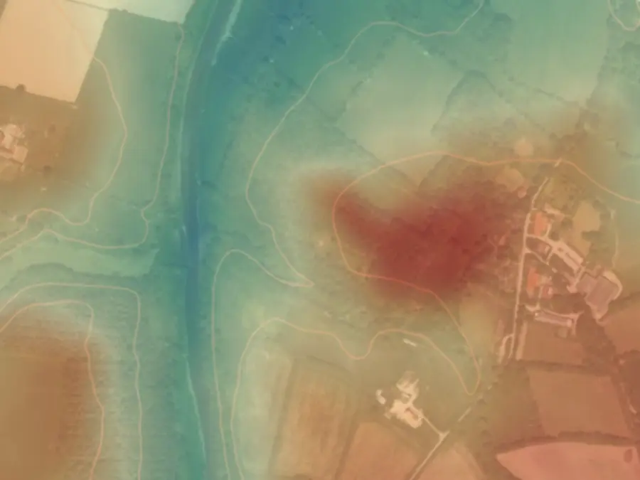
Ridges, hollows, valley floors and slopes appear on your hunting ground. Read the terrain from home rather than discovering it on the day.
Dwellings, roads, paths and watercourses come from IGN data. See what borders your hunting ground before placing a hunter.
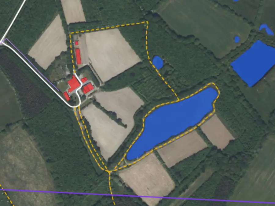
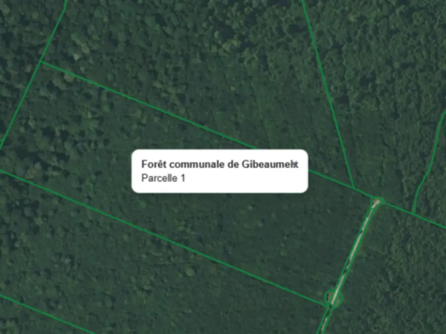
The parcel map of communal and state forests, with forest name and parcel number. Plus the agricultural parcel register, so you know what grows next door.
Infrastructure
Habitats
Terrain
Regulatory zones
Once your map is ready
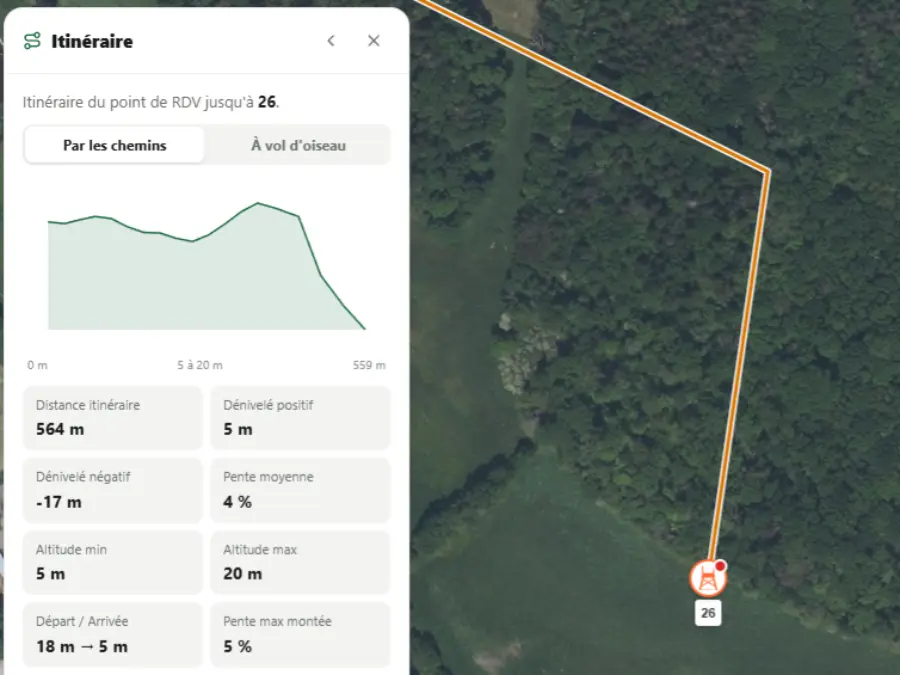
From the meeting point, the route along paths or as the crow flies, with distance, elevation gain and slope. Place the older hunters closer.
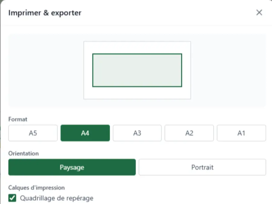
PDF export from A5 to A1, landscape or portrait, with reference grid, scale and title block. Or GPX and KML to send your stands to a GPS.
Switch between backgrounds to spot paths, edges and parcel boundaries.
The editor runs in your browser, on desktop or mobile. Nothing to download.
Open the editor and start drawing straight away. Your map carries over automatically when you create an account.
Going further
We zoom in, we zoom out, we add the overlay, it is fast, it is even faster than Géoportail.
Free to start. See paid plans.
The map for hunting
A clear hunting map is the foundation of a well-run driven hunt. Start from the exact outline of your hunting ground and its area in hectares, then turn it into driven hunt maps: enclosures, shooting lines, numbered stands, meeting point. The same map helps you prepare the season and brief the team in the morning.
To draw the boundaries of a hunting ground, the tool uses the official land registry, the forest parcel map and IGN base maps: paths, edges, parcel boundaries, relief. Unlike generic mapping applications, this French data is built in, with hunting vocabulary. To go further, see ourhunting cartography module.
The shooting sectors drawn stand by stand turn a verbal instruction into a visible reference for everyone, to print as PDF with thedriven hunt sheet on the morning of the meeting. And a hunting ground already drawn saves time on allocations and harvests: with an account, your documents are generated directly from your maps. Details on our harvest plan module.
Frequently asked questions
Yes. You draw your hunting ground, your stands and your driven hunt zones for free and without creating an account. Saving and exporting require an account, which is also free to start.
No, not to draw. The editor opens straight away, without signing up. The account is for saving, exporting and finding your maps later. Your draft is then carried over automatically.
Yes. Your zones, stands and points of interest export as GPX and KML. You can then open them in a hiking GPS, a vehicle GPS, Google Earth or the application of your choice.
The print window offers A5, A4, A3, A2 and A1 formats, landscape or portrait. You can add a reference grid, a scale with North, a title block (title, hunting ground, date) and a greyscale background to save ink.
Yes. For each stand, you draw the permitted shooting angle and the forbidden angle as defined by the hunt leader. It is a briefing aid for the morning: the instruction is shown on the map rather than repeated aloud. The map does not set the rules for you and does not replace the safety instructions in force on the hunting ground.
Rather than a blank template to fill in by hand, you start from your real hunting ground: the base map is already correct, you add your stands and zones, then print as PDF in the format you need. For the participant and stand table, use our printable driven hunt sheet.
Open the editor, choose the satellite background, then select your land registry parcels with the magic wand or lasso. The parcels join your hunting zone and the outline of the hunting ground draws itself, with its area in hectares.
Open the editor without creating an account, draw your hunting ground on the land registry, place your stands and driven hunt zones. All of this is free. The account, also free to start, is for saving, exporting as PDF and sharing the map with your team.
High seat, ground stand, pigeon hide, hide and double stand, each with its icon and number. The number shown on the map is the one you announce at the meeting point, avoiding confusion when placing hunters.
Over 150 icons related to nature and hunting: feeder, cabin, water point, car park, camera, tracks, tree species, mushroom spots, game sighted. Each point carries its icon and the name you give it.
Yes. Natura 2000 zones, nature reserves and national park cores appear as layers, with their boundaries. The map shows where these zones begin; what is permitted there depends on the text specific to each zone and the prefectoral decree.
Buildings, roads, paths and tracks, railway, overhead power lines, water points, hedges, crops declared in the graphical parcel register, public forests, relief, contour lines, slopes, national park core, nature reserves and Natura 2000. Each layer can be turned on or off as needed.
Select a stand: the map measures and shows the distance to the nearest dwelling and to the nearest path, using IGN data. The threshold to respect depends on your department's prefectoral decree, but the measurement is done for you.
Yes. The forest parcel map of communal and state forests appears with the forest name and parcel number, in addition to the standard land registry. Useful when your hunting ground does not follow the cadastral boundaries.
Partly. The satellite background, relief and drawing tools (stands, zones, drives, measurements) work everywhere, Belgium included. However, automatic parcel selection uses the French land registry: on the Belgian side, you draw your boundaries by hand instead of clicking on parcels.
The satellite backgrounds, the IGN map and the official French land registry (PCI parcels). Routes and elevations come from the IGN's BD TOPO and RGE ALTI.
Mes Chasses creates a hunting map online for free and without installation. You draw your hunting ground on the official land registry, number your stands and draw your drives from a browser, on mobile or desktop.
Yes. With a free account, you save your map and share it with your team: everyone sees the stands, drives and meeting point. On the morning of the hunt, everyone has the same map in front of them.